“It’s not about the destination, it’s about the journey.”
( This article is from 2013, the road to Long beach is still as picturesque as ever and there’s still very little development.)
Of course that all depends on where your destination is. If, for example, you were travelling from Poipet to Angkor Wat, then it’d be total bollocks as the journey is just something you endure in order to see one of the wonders of the world. There again, if you were going from Chiang Mai to Pai , along 692 bends then I’d probably agree with you as there’s nothing of interest in Pai itself.
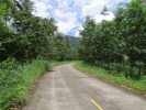
The good news is that here on Koh Chang . . . there is something worth seeing at the end of the island’s most scenic road – it’s about the destination and the journey. The road in question being the 7.057Km ( according to the sign at the start ) stretch from Ban Jek Bae to the southeast tip of Koh Chang.
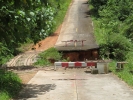
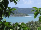
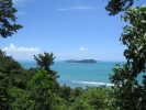
From Jek Bae village follow the only paved road heading off to the west, it is signposted to Ban Ao Luk, for the first kilometre or so the road is pretty uneventful Then the fun begins. First you have to navigate the hotel in the road, quite a large hole that covers it’s entire width. There is a makeshift bridge around it though. After crossing this the road starts to climb onto the hillside and you’ll start to get glimpses of Salakphet bay and the islands to your right. Stop off at the National park viewpoint for a cold drink and panoramic views south to Koh Laoya and the outlying islands or north into the bay and towards the hills in the centre of Koh Chang.
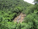
Another kilometre or so further on and there is a second viewpoint a parking area on the right with amazing views across Salakphet bay. ( There’s also a small viewpoint on the hill nearby, also on the right of the road. The steps are visible but there’s no view as the area is overgrown. )
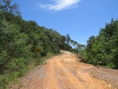
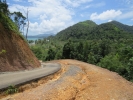
As you turn the corner after this viewpoint you immediately see where the budget for the road ran out. the final 3Km are on a rocky, dirt road. From here on you’ll need to take care not to get a puncture if you are on a scooter and if you are in a car then I’d turn back unless it has the ground clearance of a pick up truck.
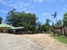
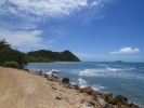
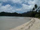
The road now drops down to sea level for a kilometre or so before another steep incline , the type where, if you are in a pick up truck you really don’t want to meet another vehicle coming the opposite direction as one of you is going to end up with their wheels down a massive rut at the side of the road. For reasons unknown there’s now a stretch old dirt road the width of a four lane highway, this narrows to a single lane concrete topped slope as you come down to the north end of Long beach. Take the turning on the right and you can park at the remains of The Treehouse – which was a popular backpacker place but is now collapsing – and walk down through the bungalows to the beach.
If you continue onwards the rocky road runs on the hillside parallel to the beach and then drops down again, take the overgrown track on the right – opposite the entrance to the never-opened Tantawan Resort down to the south end of the beach.
Follow the road another few hundred metres to the Naval memorial at Hat Yuthanavy. This commemorates Thai sailors who died in the WWII ‘Battle of Koh Chang’ . And finally you have another 400 metres drive to get to the southernmost tip of the island. There’s a small shack here selling drinks and food and in high Season have kayaks to rent – to enable you to paddle across the straight to the nearby island of Koh Ngam.
The journey . . .
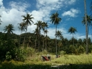
The destination . . .










Leave a Comment